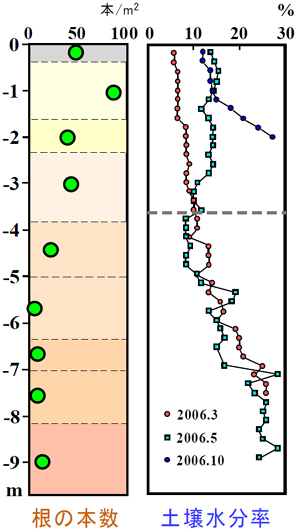
cited from Kabeya et al., (2008) |
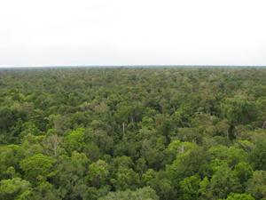
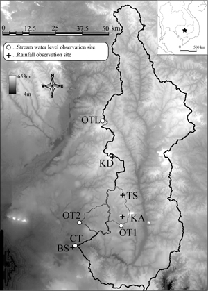
Experimental watershed of evergreen forest
We measure the runoff at four points, O Toek Loork (OTL), O Thom I (OT1), O Thom II (OT2) and Stung Chinit (CT) as shown in felt figure. And, we carry out the measurements of the rainfall at Kbal Domrey (KD), Kampub Ambel (KA), tower site (TS) and Bak Sner (BS) (Kabeya, et al., 2008).
- O Toek Loork (OTL)
- Latitude: 13°03′N, Longitude: 105°23′E
- Elevation: 89-142 m, Area of the watershed: 4 km2
- O Thom I (OT1)
- Latitude: 12°36′N, Longitude: 105°28′E
- Elevation: 46-273 m, Area of the watershed: 137 km2
- O Thom II (OT2)
- Latitude: 12°37′N, Longitude: 105°17′E
- Elevation: 19-74 m, Area of the watershed: 126 km2
- Stung Chinit (CT)
- Latitude: 12°32′N, Longitude: 105°17′E
- Elevation: 19-653 m, Area of the watershed: 3659 km2
|